6 km vandring i Mende in Lozère6 km lange Wanderung in Mende in LozèreCaminata de 6 km en Mende, LozèreEscursione di 6 km a Mende in LozèreΠεζοπορία 6 χιλιομέτρων στο Mende στη Lozère6 km vandretur i Mende in Lozère

6km hike in Mende

6 km vaellus Mendessä Lozèressa6 km fottur i Mende i LozèreRandonnée de 6km à Mende在Lozere的Mende徒步6公里6-километровый поход в Mende в Лозере6 km wandeling in Mende in Lozère
6 km Hike in Mende

Google Maps - Google Earth

IGN

Elevation Profile

Hiking circuit in Mende, Lozère of 6 km. 1Hiking circuit in Mende, Lozère of 6 km. 2Hiking circuit in Mende, Lozère of 6 km. 3Hiking circuit in Mende, Lozère of 6 km. 4Hiking circuit in Mende, Lozère of 6 km. 5

gpx-qrcode

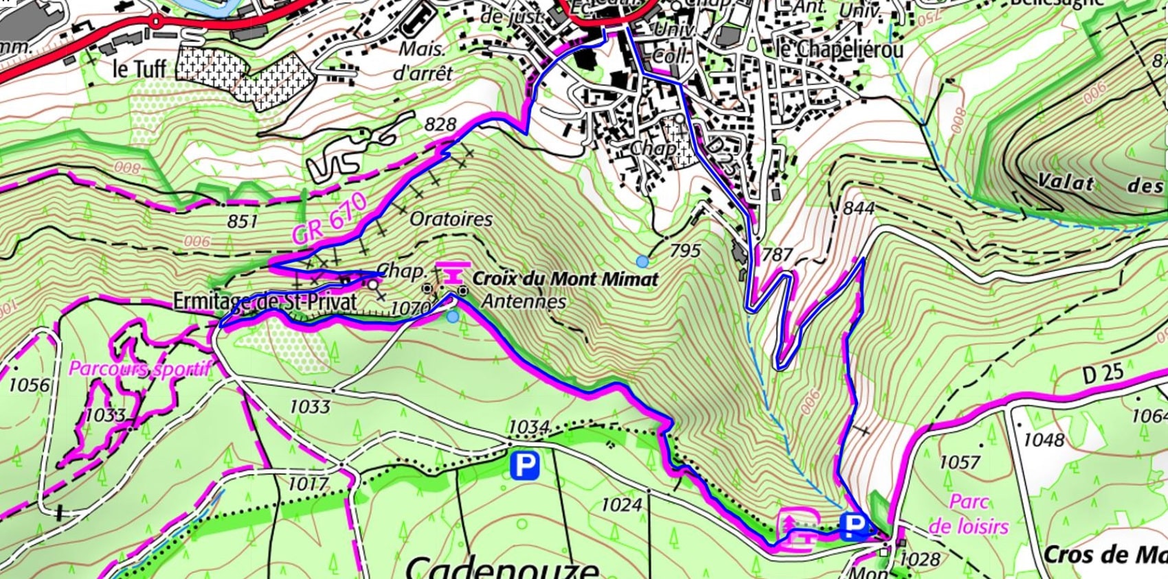
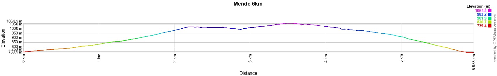
Distance: 6 km, Maximum altitude: 1061 m, Minimum altitude: 740 m, Total elevation gain: 332 m
IGN Maps: 2638SB - MENDE MARVEJOLS.


L'Etoile Guest-House between Cevennes, Ardeche and Lozere in the South of France

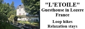
Former holiday hotel with a garden along the Allier, L'Etoile Guest House is located in La Bastide-Puylaurent between Lozere, Ardeche, and the Cevennes in the mountains of Southern France. At the crossroads of GR®7, GR®70 Stevenson Path, GR®72, GR®700 Regordane Way, GR®470 Allier River springs and gorges, GRP® Cevenol, Ardechoise Mountains, Margeride. Numerous loop trails for hiking and one-day biking excursions. Ideal for a relaxing and hiking getaway.

Copyright©etoile.fr