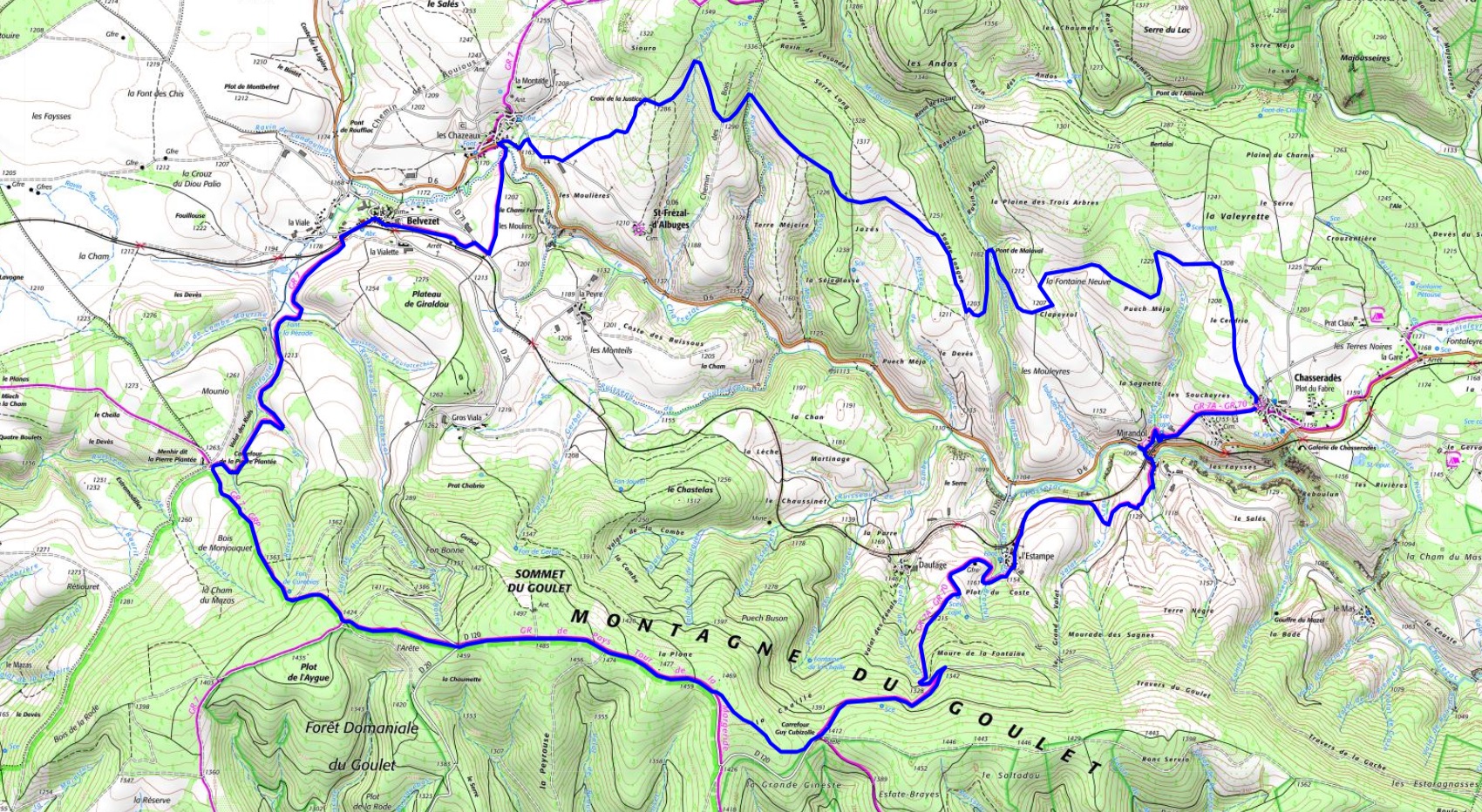
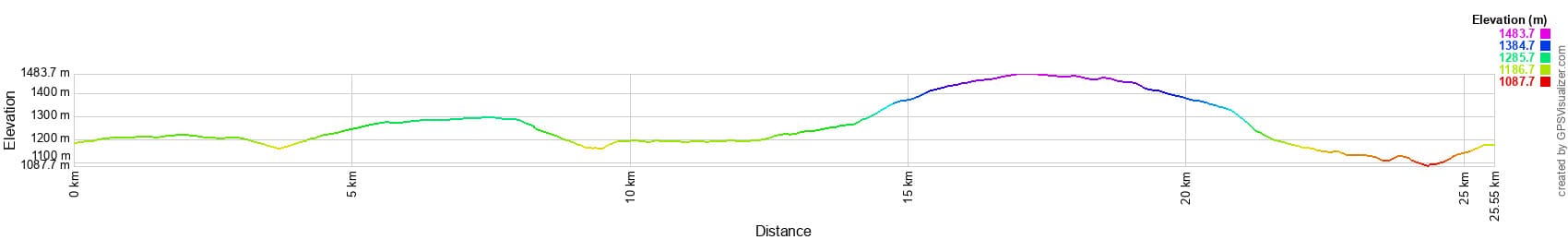
25,5 km vandring i Chasseradès i Lozère25,5 km Wanderung in Chasseradès in LozèreSendero de 25,5 km en Chasseradès en LozèreEscursione di 25,5 km a Chasseradès in LozèreΠεζοπορία 25,5 χιλιομέτρων στη Chasseradès στη Lozère25,5 km vandring i Chasseradès i Lozère

25,5 km hike in Chasseradès

25,5 km vaellus Chasseradèsissä Lozèressä25,5 km fottur i Chasseradès i LozèreRandonnée de 25,5km à Chasseradès在洛泽尔的Chasseradès进行25,5公里的徒步旅行25,5 км пешего тура в Chasseradès в Лозере25,5 km wandeling in Chasseradès in Lozère

Google Maps - Google Earth

IGN Hike of 25.5km in Chasseradès, Lozère

Elevation Profile of 25.5km Hike in Chasseradès, Lozère

Church of ChasseradèsViaduct of MirandolL'EstampePlateau de MontbelLozère

QR Code GPXDistance: 25.5 km, Maximum altitude: 1480 m, Minimum altitude: 1089 m, Total elevation gain: 601 m
IGN Map: La Bastide-Puylaurent (2738E).


L'Etoile Guest-House between Cevennes, Ardeche and Lozere in the South of France

Former holiday hotel with a garden along the Allier, L'Etoile Guest House is located in La Bastide-Puylaurent between Lozere, Ardeche, and the Cevennes in the mountains of Southern France. At the crossroads of GR®7, GR®70 Stevenson Path, GR®72, GR®700 Regordane Way, GR®470 Allier River springs and gorges, GRP® Cevenol, Ardechoise Mountains, Margeride. Numerous loop trails for hiking and one-day biking excursions. Ideal for a relaxing and hiking getaway.

Copyright©etoile.fr