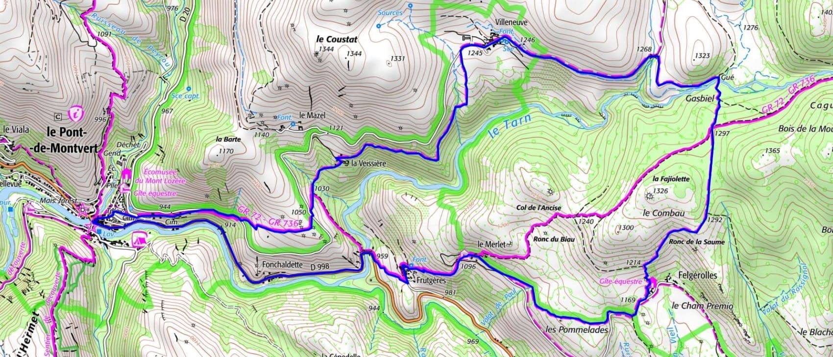

 Distance: 12.4 km
Maximum altitude: 1,300 m
Minimum altitude: 874 m
Total elevation gain: 442 m
IGN Maps: 2739OT - MONT LOZÈRE FLORAC CÉVENNES NATIONAL PARK.
Distance: 12.4 km
Maximum altitude: 1,300 m
Minimum altitude: 874 m
Total elevation gain: 442 m
IGN Maps: 2739OT - MONT LOZÈRE FLORAC CÉVENNES NATIONAL PARK.