


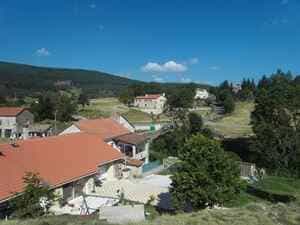
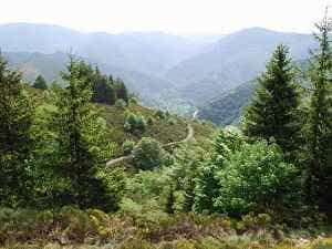
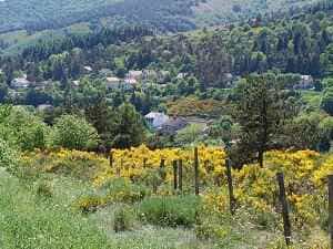
Head towards the train station and cross the level crossing. Then, turn right and follow the path that runs alongside the railway tracks. Approximately 1.5 km later, go under the railway tracks through the small tunnel, cross the Fraisse stream at the ford, and continue to Rogleton. Cross the D906 road and take the small street that climbs straight ahead, then turn right along the Serres stream. About 1 km further, veer right into the forest along the Bois de Serres stream to Felgère (the former location of the abbey), then turn left towards Coulet de Pecoyol, and right towards Croix de Pal. Turn right and descend by following the GR7, GR72, and GRP Tour de la Montagne Ardéchoise trails to Notre-Dame-des-Neiges Abbey. At the parking area, take the road to the right that ascends to the monastery, chapel, and stables. Follow the road and the markers until you reach La Bastide.
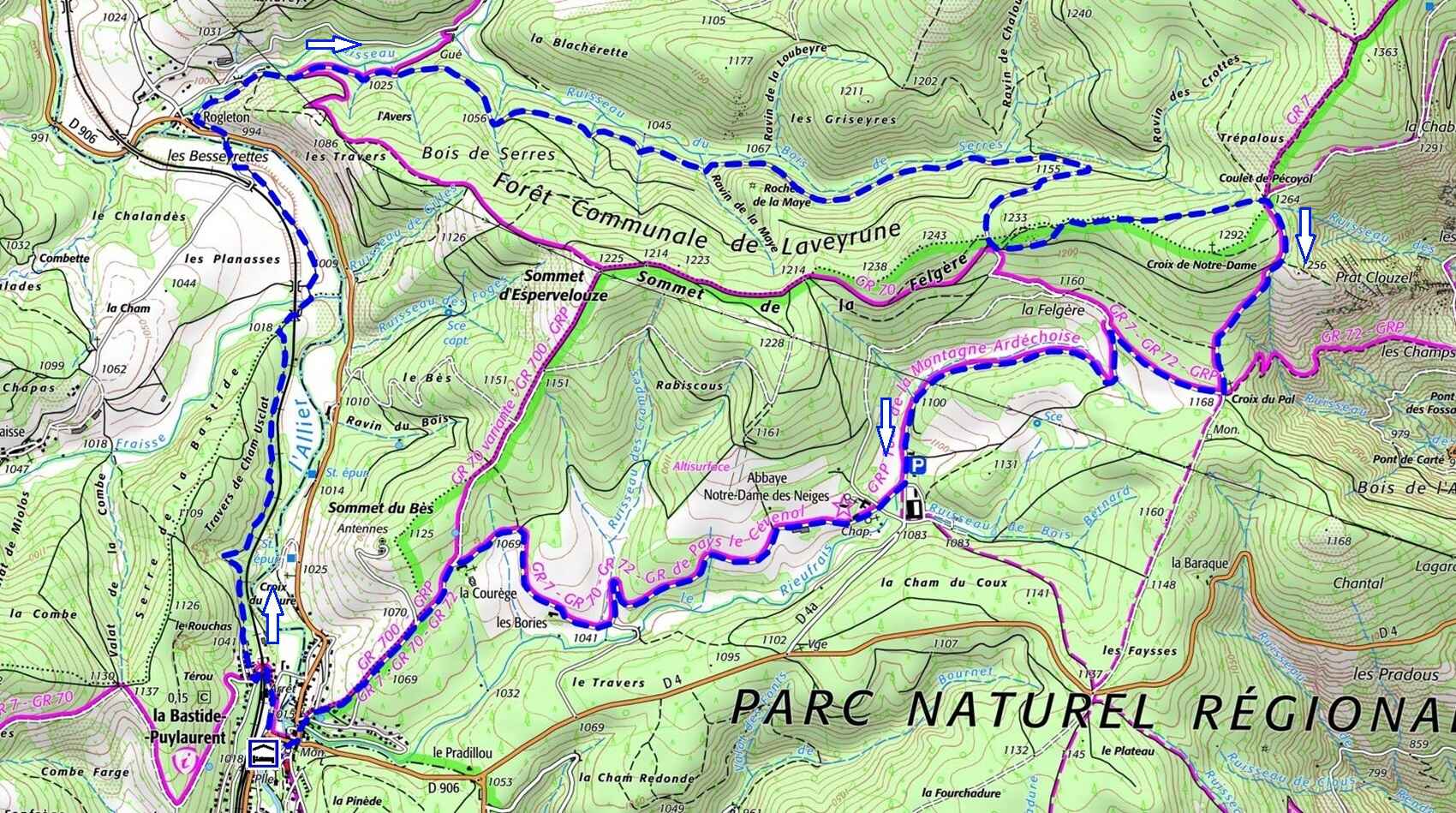
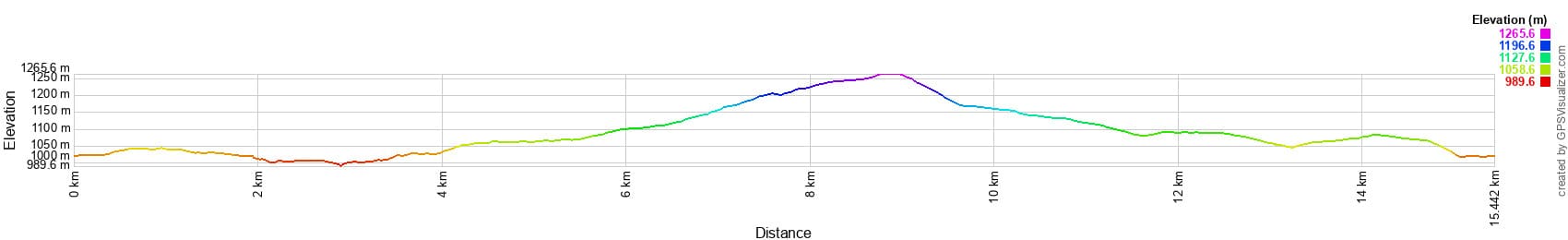
 Distance: 15.5 km, Maximum elevation: 1,264 m, Minimum elevation: 995 m, Total elevation gain: 321 m
IGN Maps: La Bastide-Puylaurent (2738E), Largentière La Bastide-Puylaurent Vivarais Cévenol (2838OT)
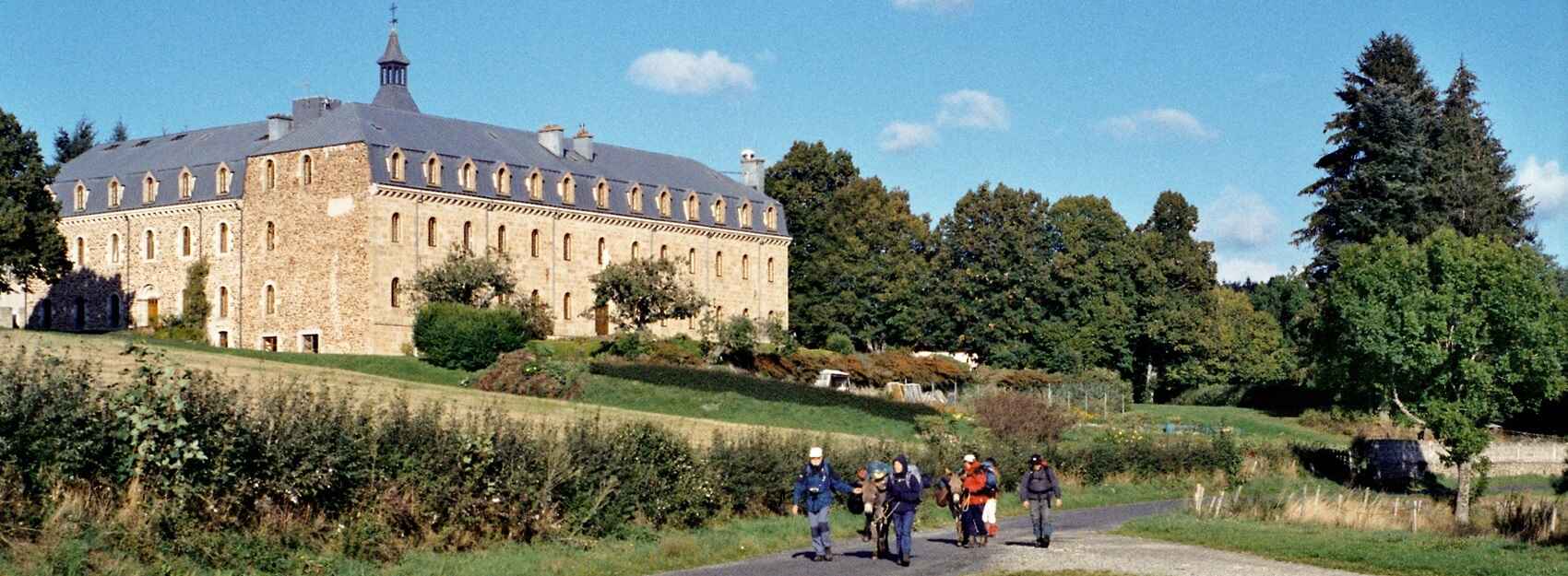
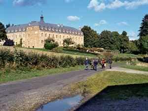
The Abbey of Notre-Dame-des-Neiges, located in Saint-Laurent-les-Bains-Laval-d'Aurelle in Ardèche, is a place of peace and spirituality. Founded in 1850 by Trappist monks from the Abbey of Aiguebelle, for more than 170 years the abbey was a centre of spiritual life and manual work for the Trappist monks. These monks were seeking a place of solitude and prayer, and they found in the Ardèche mountains an ideal setting for their monastic life. In 2022, due to a decline in the number of monks, the community was replaced by Cistercian sisters from the Abbey of Boulaur. These sisters continue the tradition of prayer and hospitality, maintaining the continuity of monastic life in this place. The abbey is located at an altitude of 1,100 metres, offering panoramic views of the surrounding mountains. The abbey gardens, carefully maintained by the sisters, are a haven of peace where visitors can stroll and meditate. The natural environment around the abbey is rich in biodiversity, with forests, meadows and rivers adding to the serenity of the place. Monastic life at the abbey is punctuated by religious services open to the public. The sisters devote themselves to prayer, manual work and welcoming visitors. They also produce artisanal products — jams, herbal teas and care items — sold to support the community. The abbey offers the possibility of spiritual retreats, allowing visitors to recharge in a peaceful and contemplative setting.
In September 1878, while travelling through the Cévennes accompanied by his faithful donkey Modestine, the Scottish writer Robert Louis Stevenson was captivated by the majestic silhouette of the Notre-Dame-des-Neiges abbey. Intrigued, he decided to enter this isolated monastery for an encounter that would forever mark his journey. To his great surprise, Stevenson was welcomed with a warmth and simplicity that contrasted with the austerity of the place. The Trappist monks offered him hospitality with sincere kindness. Stevenson was given room and board, and he was quickly integrated into the peaceful life of the monastic community. Immersed in the heart of monastic life, he was fascinated by the rigour and discipline that reigned within the abbey. He observed with wonder the regular prayers, the manual work of the monks and the soothing silence that enveloped the place. At the same time, he discovered the splendour of the surrounding landscapes, wild and grandiose, which stimulated his imagination. From his stay at the abbey, Stevenson wrote a poignant account entitled "Travels with a Donkey in the Cévennes".
Charles de Foucauld at Notre-Dame-des-Neiges abbey: a decisive spiritual step. In 1889, Charles de Foucauld, a young French aristocrat in search of meaning and spirituality, entered the Notre-Dame-des-Neiges abbey to embrace monastic life under the name of Brother Marie-Alberic. This moment marked the beginning of a deeply spiritual journey that would significantly influence his life and work. Coming from a wealthy family and having led a worldly life, he felt an urgent need to find deeper meaning. His encounter with spirituality drew him towards a life of simplicity and contemplation. The Notre-Dame-des-Neiges abbey became for him a refuge where he sought answers to his most intimate questions. Embracing the Trappist community meant adopting an austere and disciplined way of life: days punctuated by liturgical prayers, manual work and silence, offering an environment conducive to meditation and contemplation.