


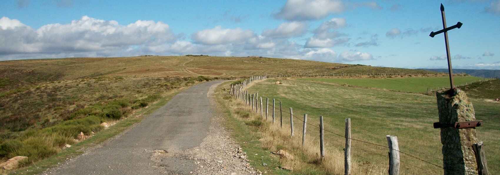
Take the D6 road along the Allier River via Les Huttes, Masméjean, Chabalier, and Chasseradès. Turn left at the entrance of Chasseradès onto the small road heading toward Puylaurent for 1.2 km up to Grossefage, then take the small road to the right via Chadepeau, the Croix du Clas, and La Fare. Cross the bridge over the Chassezac at Prévenchères and turn left twice toward Puylaurent and Chasseradès. 1.7 km after Puylaurent, turn right toward Les Gouttes and La Bastide-Puylaurent until you reach the dolmen at the entrance to Le Thort. Take the small road descending to the right that joins the D906. Turn right onto the D906 for 1 km, then take two consecutive left turns onto the old abandoned road (former D906) up to the Pradillou roundabout. Turn left descending toward La Bastide-Puylaurent.
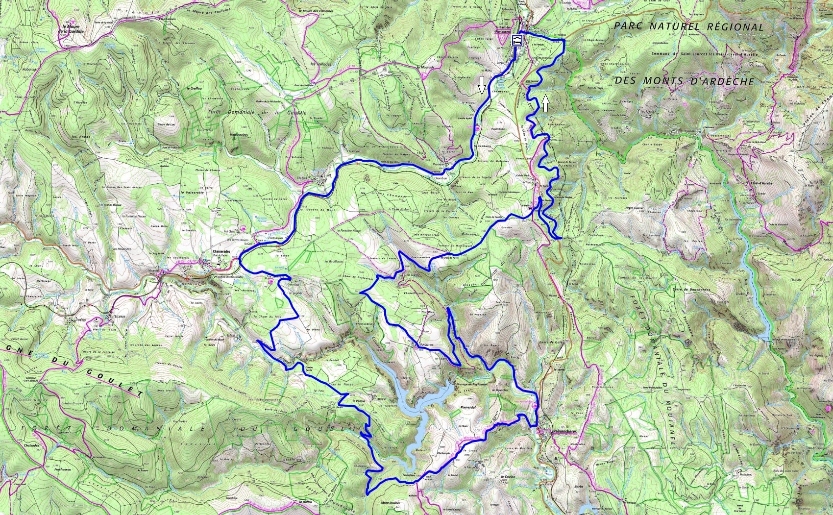
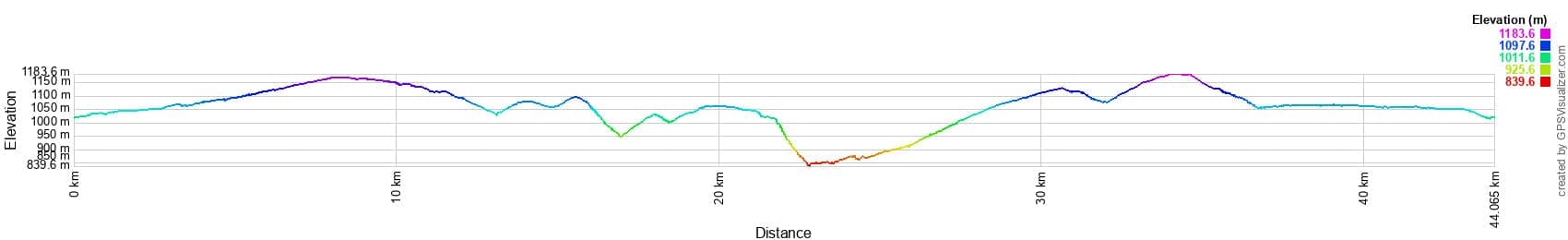
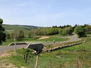
 Distance: 44 km. Maximum altitude: 1,182 m. Minimum altitude: 842 m. Total elevation gain: 781 m.
IGN Maps: La Bastide-Puylaurent (2738E). Largentière, La Bastide-Puylaurent, Vivarais Cévenol (2838OT).
Print the route - Bicycle rentals
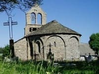
Chasseradès is an ancient commune that has beautifully preserved its rural charm and historic heritage. Its stone houses, often topped with traditional lauze (slate) roofs, are typical of Lozère architecture. The village boasts a 12th-century church dedicated to Saint-Blaise. This Romanesque building is a fine example of the region's religious architecture, having been carefully restored over the centuries while retaining its medieval character. The village is also famous for its railway viaduct, built for the former Compagnie du Midi train line linking Clermont-Ferrand to Nîmes. With its imposing arches, the Chasseradès viaduct stands as an impressive testament to 19th-century engineering.
The etymology of Prévenchères dates back to the Middle Ages and is deeply intertwined with the region's ecclesiastical history, once dominated by the Abbey of Saint-Gilles. The earliest known mention of the village, recorded as Sancti Petri de Prevencheriis, appears in a 1119 papal bull by Pope Callixtus II confirming the abbey's possessions. The name likely stems from the presence of a priory or church dedicated to Saint Peter (Sancti Petri). Over time, the name evolved into the Prévenchères we know today. Nestled in the green heart of Lozère, the village stands as a sentinel of time, its roots firmly anchored in medieval history. The Regordane Way—a bustling route for merchants and pilgrims—ran through these lands, linking Le Puy-en-Velay to Saint-Gilles-du-Gard. This vital artery witnessed the legendary exploits of William of Orange and served as a thoroughfare for those journeying to the tomb of Saint-Gilles or the Black Virgin of Le Puy.
At the heart of Prévenchères, the village's judicial past comes alive beneath the rustling leaves of an ancient linden tree, where judges once dispensed justice. More than just a tree, it is a symbol of community, said to have been planted by the Duke of Sully to celebrate the birth of the future King Louis XIII. Its sturdy trunk and sprawling branches have weathered passing seasons and centuries, remaining an unshakable gathering point for the locals. Just a stone's throw away stands the 12th-century church, a jewel of Romanesque art, whose broken barrel vault was rebuilt in the 17th century. The choir, the beating heart of the building, is a masterpiece of sculpted granite where every detail feels like a prayer petrified in stone. Neighboring churches, such as those in La Garde-Guérin and Puylaurent, share this same architectural language—a dialect of granite and faith that unites the region in silent brotherhood. The building bears the deep scars of the Wars of Religion, with recent restoration work on the nave's northern wall revealing the original architectural decorations.