


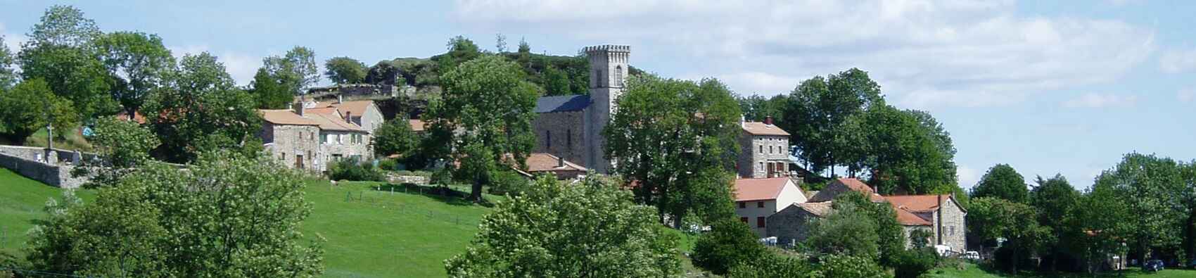
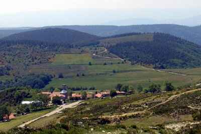
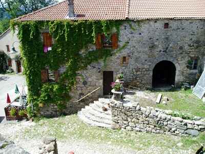
A typical small village in Haute-Ardèche, Loubaresse nestles at the foot of the Tanargue massif, overlooking the Valgorge valley. The village centre features a small grocery store, a restaurant, and a highly regarded guesthouse offering meals, whose reputation extends throughout the Ardèche.
It is here that mushroom foragers from Alès, Aubenas, and Largentière stop for lunch. In the evening, hikers take over, whether they are completing the Tour of the Tanargue, the Montagne Ardéchoise loop, or the alternative Cévenol trail arriving from La Bastide-Puylaurent via Saint-Laurent-les-Bains and Borne.
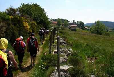
The Cévenol remains one of the most beautiful trails in the region, typically taking 5 to 7 days to complete on foot.
Leaning against the edge of the Tanargue, this high-altitude village (1,250 m) is the smallest municipality in the department. Its sturdy granite and basalt houses are tightly clustered around the church. Interestingly, the church's crenellated bell tower was built using the remains of an old watchtower originally constructed by the Lord of Borne.
The etymology of its name likely stems either from the wolves that once roamed the region, or from the Occitan expression laoubo recento (the early dawn), as the village is perfectly positioned to catch the very first rays of the rising sun. Maggy Merle, a true local personality, runs the small grocery store and also records valuable data for Météo-France.
The Valgorge Valley
The name is thought to derive from vallis gurgulionis, designating a valley that emerges from a gorge—a narrow bottleneck where the Beaume river flows in. Nestled at the foot of the imposing southern face of the Tanargue, this deeply secluded area has drawn numerous writers over the years.
Notably, the poet Ovide de Valgorge was born at the Château de Chastanet. Later, Albin Mazon (under the pseudonym Doctor Francus), an eminent historian of the Ardèche, crisscrossed the entire region on muleback. The British writer Kenneth White lived here for several years, drawing inspiration from these landscapes for his famous Letters from Gourgounel. Simone de Beauvoir also recounts a memorable stay here in 1935 in Histoire de Drailles. During the Second World War, she even returned by bicycle with Jean-Paul Sartre to spend a holiday in the free zone.
Taranis was a Celtic deity: the god of thunder! Legend has it that he took up residence in the Tanargue massif, an impressive rocky ridge in southwestern Ardèche. As Pierre Veyrenc wrote on 23 June 1867: "...the devil took the Tanargue! Lightning has struck once again, killing 2 shepherds and 203 sheep..."
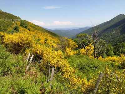
Nestled at its feet, with just 32 inhabitants at the last census and covering 900 hectares, Loubaresse is the smallest village in the department. Situated at an altitude of 1,250 metres, at the gateway to the Montagne Ardéchoise, its climate constantly wavers between Mediterranean and oceanic influences, caught between the foothills of the Cévennes and the harshness of the plateau. Shielded by the edge of the Tanargue, which abruptly halts cloud-bearing winds from the southeast, the village receives heavy rainfall (averaging 2,100 mm per year) but, due to the steep terrain, is unable to retain this water.
Within just a few hours, the water cascades down the slopes, swelling the tumultuous Beaume river, which has its source at Rochemisole above the village. As the local saying goes: when the rain taps a rhythm in the region, it’s in Loubaresse that you hear it the loudest! While it doesn't necessarily rain more days here than elsewhere (summers are actually quite dry), when it does rain, it pours in earnest.
The silver fir, an evergreen conifer, stands proudly with a tapered trunk and horizontal branches. Much like the Scots pine, it possesses numerous medicinal properties. Locally, it is traditionally chosen as a pibou (maypole) to be erected in front of the home of a newly elected official to celebrate and honour them. As a premium timber tree, it yields high-quality wood that is highly sought after for carpentry and joinery. In these lands, it frequently grows alongside another species of conifer: the Norway spruce.
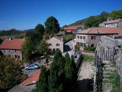
The Ardèche, a region well worthy of capturing both the artist's eye and the naturalist's mind, harbours several little-known areas that certainly do not deserve the obscurity into which they have sometimes fallen. Such is the domain of Ubas, which spans a circumference of seven leagues. Located at the western edge of the department in the canton of Saint-Étienne-de-Lugdarès, roughly eight leagues northwest of Largentière, this territory is bordered to the north, east, and south by hills that gradually rise to form the volcanic mountain of Prasoncoupe. Its name translates to "crater of the meadows" owing to its commanding position over beautiful grasslands, reaching an altitude of nearly 1,000 metres above the Mediterranean.
Thanks to the abundance of its ancient lava flows, this volcano remains one of the most significant in the Vivarais. Had the early naturalists who explored the region visited it, they would undoubtedly have placed the Loubaresse volcano at the very forefront of interest. From its depths spring the thermal waters that bring wealth to the village of Saint-Laurent-les-Bains. Without the prestigious reputation of these springs, the village would likely languish, isolated and nearly deserted at the bottom of its narrow, bowl-shaped valley, bristling with partially weathered rocks that create a striking scene of mineral chaos. From the summit of Prasoncoupe, however, the scenery changes radically: the rocky aridity gives way, all around the volcano, to the lush fertility of a landscape blanketed in dark woods, verdant meadows, abundant waters, and cultivated fields.
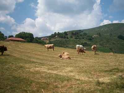
From the peak of the Loubaresse volcano, one enjoys a majestic view over the Valgorge valley, widely regarded as the most picturesque in the Vivarais with its thousands of soaring peaks and spires. Its rich and varied vegetation offers walkers an unexpected succession of landscapes, alternating between the charmingly idyllic and the profoundly wild. Furthermore, it was at the Château de Valgorge, situated in the most fertile part of the valley, that the Marquis de La Fare penned the famous verses that immortalized him.
Long ago, towering over the high peaks of these cold lands, stood four imposing towers: those of Loubaresse, Borne, Saint-Laurent-les-Bains, and Luc. When the nights grew dark, immense bonfires were lit at their summits. These veritable lighthouses illuminated the surrounding countryside from afar and served as crucial beacons during the disastrous and frequent feudal wars between lords. Of these four towers, one has already vanished.
Erected 1,242 metres above sea level, right upon the filled-in crater of one of the oldest extinct volcanoes in the Vivarais, this tower lent a strikingly picturesque quality to the landscape from afar and had long been spared by the ravages of time. Alas, less than five decades ago, a man with little regard for old stones had it entirely demolished and levelled to the ground to reuse its materials for the reconstruction of the parish church in Loubaresse.
From the old Chambons abbey to Loubaresse—a village once populated exclusively by muleteers, robust and hardy mountain folk possessing the courage and skill of Andalusian muleteers, albeit with perhaps a little less grace and elegant coquetry—and from Loubaresse to Chat-del-Bos, along the road to Saint-Laurent-les-Bains (located just a league away), every clearly defined path suddenly vanishes. Before you lie only vast meadows and fields stretching as far as the eye can see, across which both animals and people wander wherever the adventure takes them.
A multitude of streams continuously intersect and shape the rugged terrain you traverse. Almost all of them make far more noise than their size would suggest. This is, moreover, a point worth noting: in these mountains, the waterways possess a wild, impetuous, and dizzying character—a turbulent energy never found in the peaceful, flower-lined streams of our plains.