


Tourism in the past in the Vans region


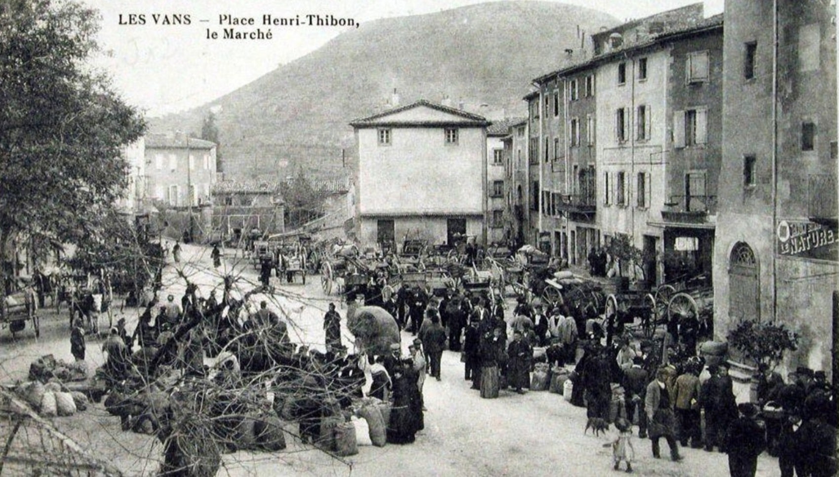
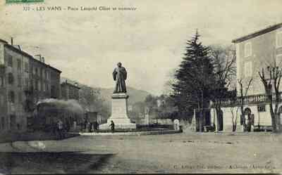
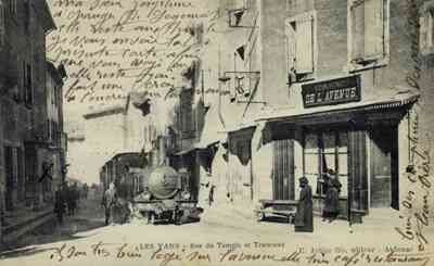
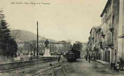
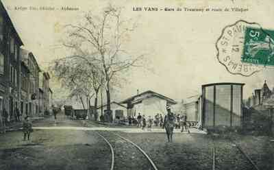 Les Vans (175 m; buses to Alès, Largentière, Aubenas and Vals, to Villefort and Montélimar; Dardaillon Hotel, Léopold-Ollier Square, 14 rooms; Château du Scipionnet, 2 km to the northeast, 13 rooms; Syndicat d'Initiative, Town Hall street, phone 31), 1,632 inhabitants, located in a small valley opening northeast onto the Chassezac valley. On Léopold-Ollier Square stands a monument to the surgeon Ollier, who was one of the first to successfully perform joint resections in Lyon. The church features a beautiful carved beechwood altarpiece. In the hospital garden, you can find a Roman-era gravestone inscription. There are lovely walks in the surroundings along the banks of the Chassezac River.
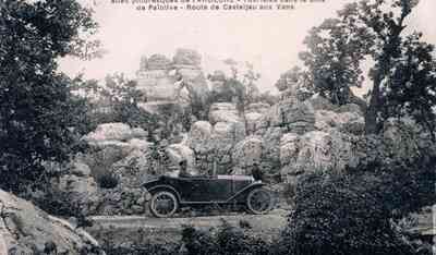
 The Olivier Wood (Bois de Païolive) (2 hours for a brief visit, 4 hours for a detailed tour). Crossed by the Chassezac River and stretching east of the N 101 road, it is one of the strangest natural wonders in the Vivarais region. An in-depth visit requires about 4 hours on foot, and a guide is essential; the guide’s house is located on the edge of the forest, in the Mège Valley, 5 km east of Les Vans on the N 101. Tourists with limited time can get a feel for the Païolive landscape by taking the road that crosses the forest near Mège. It offers a beautiful view of the Chassezac gorge at the exit, tracing a long loop around the steep promontory of Casteljau, allowing for nearby exploration on foot (about a 20 km round trip).
It is impossible, through mere description, to guide tourists through the marvels of the forest, a gigantic labyrinth of white limestone rocks, with horizontal strata broken in all directions, arranged in circles, terraces, and fantastic architectures. A beautiful vegetation of oaks and mulberry trees shades this vast chaos through which the Chassezac has carved a picturesque canyon. We will only indicate, in the usual order of the visit, the main curiosities of the forest.
From the Mège Valley, you ascend on large limestone slabs towards Saint-Eugène Chapel, built on a vast limestone table: there is a very beautiful view over the Chassezac valley, the basin, and the village of Chassagnes; to the west over the Tanargue mountain range, and far to the east over Mont Ventoux. Opposite, on the other side of the river, rises the Cornillon promontory with ruins of an ancient village; towards the southeast, the Endieu cliff extends on the right bank.
 We descend on the right bank of the Chassezac; on the left bank is the Barres Cave. We pass through the narrow fissure of the Gleizasse ravine, then, climbing back onto the wall of the right bank, we reach a wide ledge about a meter deep, winding along the vertical wall and remaining about 30 meters above the Chassezac.
 Turning left, you enter a small, lush ravine between two large rocks, and soon arrive at a tunneled rock at Gleizasse, known in the local dialect as "the great church". It is a cave or vestibule formed by two large inclined rocks with upper fissures that let in daylight, offering a very interesting view of the left bank of the river. Then you see the Rotunda, a veritable dance hall on a flat, level surface.
Beyond the castle of the Three Lords, where some shapeless ruins merge with the rock, you reach the wildest part of the forest, the Gagnière Woods district. It’s a vast maze of stone, heavily wooded, covered with vegetation and brambles, where the rocks take on the strangest shapes.
One of the most beautiful sites is called the "Salon": there, on shaded lawns beneath magnificent trees, rise large monolithic rocks, such as Lot’s Daughter, the Nun, etc. In the wall of a gigantic block, surrounded by brambles, a slit opens serving as a niche for a Virgin statuette, which is only visible when you approach almost to the foot of the rock. Not far away, in a small enclosure of rocks, a spring gushes from a fissure in a large stone.
 Returning towards the Mège Valley, you can visit the Creux de la Perdrix, located a few minutes off the road, as well as the Cave of L’Assiette. Conversely, if you continue through the forest southeastward, you reach the region of the dolmens: beyond the Rages Forest, the rocks gradually become shorter and the trees thinner; bushes follow, and you enter a desert of white stones inhabited by dolmens. You would thus arrive at Berrias, 10 km from Les Vans, but it is only 3 km from Berrias back to Route N 101.
 Variant from Les Vans to Villefort via the Borne road (27 km, only 3 km longer, very scenic but narrow and quite difficult; check the road condition before setting out). Initially, follow the direct route to Mende for 1.5 km, passing the curious group of 15 rosary reliefs. Then turn right, after the hamlet of Armes-Bas, cross a ravine and climb again. Gravel paths lead to a Romanesque church containing a sculpted Tree of Jesse from the 14th century. A gravel bridge (170 m) crosses the Chassezac where it emerges from the gorges. Leave a small local road on the right, which follows a wild ravine where a small tributary of the Chassezac flows, leading to Thines (10 km).
Thines, 181 inhabitants, a poor village built on a steep pinnacle (542 m high) in a wild and magnificent site, preserves a Romanesque church that is among the most interesting in the Vivarais and nevertheless relates to the architecture of the Velay. Likely built in the first quarter of the 12th century, it is a granite structure consisting of only a vaulted nave and a semi-circular apse, the latter remarkable for its polychrome masonry and the elegance of its external decoration. The sculpture on the south side portal, from the last quarter of the 12th century (after 1175), resembles, according to Mr. Paul Deschamps, the major Provençal ensembles of Saint-Gilles and Saint-Bernard de Romans; the lintel depicts the Entry of Christ into Jerusalem and the Scene of Judas’ Kiss, while the tympanum dates only from 1862. The church houses a wooden Virgin from the 13th century, seated on a throne and holding the Child on her knees. A monument was erected in the hamlet of Tastevin in memory of twelve Resistance fighters, a peasant, and an elderly woman shot here by Germans on August 4, 1943.
 Lafigère is on the right on the hilltop. The road from Villefort climbs the valley, which gradually changes; shales give way to granites. Following northwest along the left bank, it traces all the bends of the Chassezac torrent. Sainte-Marguerite-Lafigère offers a magnificent view of the Pied-de-Borne site; in the valley, a factory processes lead-silver ore, copper, etc., from the Chassezac concession. Crossing the Borne, a left tributary of the Chassezac, via a beautiful bridge (border of Ardèche and Lozère) opposite the picturesque Sainte-Marguerite chapel, you then descend the right bank of the Borne. On the left, perched on the mountain slope, are the hamlets of Planchamp, featuring the beautiful castle where the politician Odilon Barrot (1791-1873) was born.
 Pied-de-Borne is a hamlet accessible via a beautiful bridge over the Chassezac, situated in an incredible site at the foot of the Planchamp mountain and at the confluence of the three wild gorges of the Chassezac, the Altier, and the Borne.
Borne is a natural region that includes not only the Borne valley, but also the upper parts of the Altier and Chassezac with their numerous secondary gorges; this granitic region, in its upper part, is more deeply scarred, wilder, and more beautiful than most of the Cévennes. The mountain dwellers have built terraced farms and vineyards on the slopes, and laid out small irrigation channels, known locally as "béals", to bring water to their crops. Beautiful chestnut groves cover the steep rocky slopes, and further down, you will find olive trees and holm oaks.
The road gently ascends the right bank of the Altier at the bottom of a magnificent gorge filled with chestnut trees, then leaves the Altier on the left to follow the right bank of the Palhères torrent.
From Les Vans to Villefort, the N 101 route is magnificent. After leaving Les Vans, it quickly climbs through the chestnut trees via a steep, winding ramp, dominated on the left by the rugged slopes of Mount Malons (997 m) and on the right by the Chassezac valley, offering extensive views. At the Col du Mas de l’Air (850 m), the road descends quickly and winds into the upper Cèze valley. It then joins route N 106, which is followed to the right to cross the small pass of Villefort (655 m), situated between the sources of the Cèze and the valley of Palhères.
by Jean Jacques Fauvel. Cévennes, Languedoc: Rouergue, Albigensian, Causses, Gévaudan, Velay, Vivarais
Copyright©etoile.fr